What Is EXIF Data? A Beginner's Guide to Hidden Photo Metadata
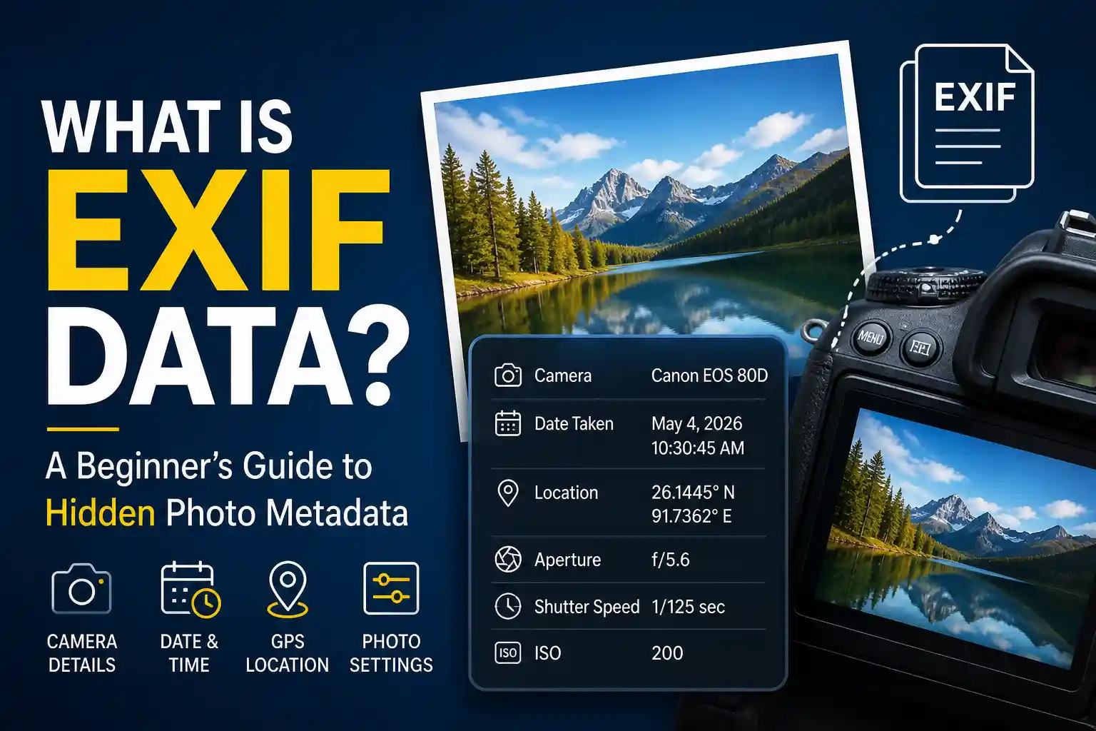
If you have ever opened a photo and wondered how your phone seems to remember the exact time, camera settings, and even the place where it was taken, the answer is usually EXIF data. It is the hidden metadata attached to many image files, and it quietly carries useful information behind the scenes.
For casual users, EXIF data is simply a technical detail. For photographers, field teams, and anyone who uses GPS location-stamped photos, it can be a valuable record.
In this beginner-friendly guide, you will learn what EXIF data is, what it contains, why it matters, and how to view, edit, or remove it when needed.
Table of Contents
What Is EXIF Data?
EXIF stands for Exchangeable Image File Format. It is an international standard — formally defined as JEITA EXIF 2.32 — that specifies how cameras and smartphones store metadata alongside the pixel data inside image files. Every time you take a photo, your camera doesn't just record the visual scene; it also writes a structured block of data describing how, when, and sometimes where that image was captured.
This metadata block travels invisibly inside the file. Open the photo on your phone and you see the image. Open it with an EXIF reader and you see dozens of additional fields — camera model, lens focal length, shutter speed, GPS coordinates, and much more — none of which are visible in the picture itself.
EXIF data is supported by JPEG, HEIC, TIFF, and some RAW formats. PNG files do not support the EXIF standard, which is one reason screenshots rarely contain location or camera data even when taken on a GPS-equipped phone.
What Does EXIF Data Store?
The EXIF standard defines hundreds of possible fields, though most cameras only write a subset of them. Here is a breakdown of the most practically important categories:
Camera and Device Information
Every EXIF-enabled camera records the device that created the image. This includes the manufacturer (Apple, Samsung, Canon, Nikon), the exact model number, and sometimes the firmware version. For smartphones, this often includes the specific camera module (for example, "iPhone 15 Pro rear triple camera 6mm f/2.8"). This data is useful for organizing large photo archives by device, or for verifying which device was used to capture a specific image.
Exposure and Technical Settings
Photographers rely heavily on EXIF data to review and improve their technique. The fields recorded typically include ISO sensitivity, shutter speed (exposure time), aperture (f-stop), focal length, whether flash fired, white balance setting, metering mode, and exposure compensation. After reviewing a blurry photo, a photographer can check the EXIF and immediately see that the shutter speed was too slow — information that would otherwise require guesswork.
Date and Time
EXIF stores three separate timestamp fields: DateTimeOriginal (when the shutter fired), DateTimeDigitized (when the image was processed), and DateTime (when the file was last modified). These are independent of the file's creation date in the operating system, which can change when a file is copied or moved. The EXIF timestamp is typically the most reliable record of when a photo was actually taken — unless the camera clock was incorrectly set.
GPS Location Data
When location services are enabled for your camera app, the EXIF GPS fields are populated at the moment of capture. The core fields are GPSLatitude and GPSLongitude, expressed in degrees, minutes, and seconds. Additional GPS fields can include altitude, the compass direction the camera was pointing (GPSImgDirection), GPS timestamp, and the measurement mode (2D or 3D fix).
These coordinates are stored with high decimal precision, though actual accuracy depends on GPS signal quality at the time of capture. In good conditions outdoors, modern smartphones achieve 3–5 metre accuracy. In urban areas with tall buildings or indoors, drift of 10–50 metres is common. For the full explanation of how GPS works inside a smartphone, see our guide: How GPS Works in Smartphones for Photographers.
Image Technical Details
EXIF also records the image dimensions in pixels, colour space (sRGB or Adobe RGB), compression method, resolution in DPI, and the orientation flag — the last of which is what tells your phone to rotate the image correctly when you tilt the camera to shoot portrait. Orientation data loss is a common cause of photos appearing sideways when opened in certain software.
Why EXIF Data Matters
For Photographers
EXIF data is the photographer's feedback loop. After a shoot, reviewing EXIF fields reveals exactly which settings produced which results — the ISO that introduced grain in a night shot, the focal length used for a portrait that looked compressed, the aperture that gave a wider depth of field than intended. Professional photographers routinely sort their best images by EXIF settings to identify patterns in their technique. Many post-processing tools like Lightroom and Capture One display EXIF data prominently in their interfaces for exactly this reason.
For Field Documentation and Professional Work
In construction, inspection, real estate, and logistics, EXIF data — particularly the GPS coordinates and timestamp — adds an additional layer of context to photo records. An engineer reviewing progress photos can see exactly when each image was taken and correlate it with the project schedule. An insurance adjuster can cross-check the timestamp against the incident report. A delivery supervisor can verify the time a proof-of-delivery photo was captured.
That said, EXIF data has a critical weakness for professional documentation: it is invisible unless you specifically open it with a metadata reader, and it can be stripped or edited by many tools and platforms. This is why professionals who need verifiable location records increasingly use visible GPS stamps burned onto the image — a stamp is readable by anyone looking at the photo without needing any special tool. You can read the full comparison in our construction site documentation guide.
For Photo Organization
Photo management apps — Google Photos, Apple Photos, Adobe Lightroom, and others — use EXIF data extensively to automatically organize images. The date fields drive chronological sorting. The GPS fields power the "Places" maps that show where photos were taken. The camera model field enables filtering by device. When EXIF data is stripped or corrupted, these organizational features break down — photos lose their dates, their locations disappear from maps, and automatic albums fail to group correctly.
Why EXIF Data Can Disappear
This is one of the most frequent frustrations people encounter. You take a photo with location services on, share it, and the recipient finds no GPS data when they check the file. Here's exactly what happens in each scenario:
Messaging Apps Strip It Automatically
WhatsApp, Instagram, Facebook Messenger, Telegram (in "photo" mode), and most messaging apps automatically remove all EXIF metadata before delivering a photo to the recipient. This is intentional — the platforms do it as a privacy feature to prevent people from unknowingly sharing their home address or location when sending photos to strangers. The file the recipient gets is a re-encoded copy without any metadata. To preserve EXIF data when sharing, send the original file as a document attachment rather than as a photo. In WhatsApp, for example, use "Document" instead of "Gallery" when attaching the file.
Social Media Re-encodes Images
Instagram, X (Twitter), Facebook, and similar platforms re-encode all uploaded images to reduce file size and standardise format. This re-encoding process rebuilds the image file from scratch — and the rebuild typically does not include the original EXIF block. Even if a platform preserved some metadata fields (some do retain basic copyright tags), GPS data is almost always removed. This is standard practice across the industry and is not something that can be worked around on the sender's side.
Editing Tools Remove It During Export
Some image editors — particularly older versions or web-based tools — strip EXIF data when saving or exporting. Microsoft Paint, for example, removes all metadata when you save a file through it. Even professional tools like Photoshop can strip GPS data if the "Remove Location Information" export option is checked. If you edit a photo and the resulting file has no metadata, check the export settings of the tool you used.
Format Conversion
Converting between image formats — particularly from HEIC (iPhone's default) to JPEG — can sometimes lose metadata depending on the conversion tool used. Apple's built-in conversion preserves EXIF, but third-party online converters often do not. Similarly, converting to PNG always loses EXIF data because the PNG format does not support EXIF natively.
Location Services Were Never On
If your camera app did not have location permission at the time the photo was taken, no GPS coordinates were ever written into the file. There is nothing to recover in this case. If this happens regularly, check your phone's location permission settings for the camera app specifically. For photos already taken without GPS data, you can add location manually using our GPS Map Camera Editor — it burns a visible location stamp onto the image rather than writing to the EXIF layer.
If you have lost GPS metadata from photos after export or processing, our guide on recovering lost GPS location data from exported photos covers what options are realistically available.
How to View EXIF Data
There are several ways to inspect EXIF metadata depending on your device and how much detail you need.
On Windows
Right-click any JPEG image and select Properties, then open the Details tab. Windows displays a curated subset of EXIF fields including camera make and model, date taken, dimensions, and GPS coordinates if present. For the full set of EXIF fields, a dedicated viewer is needed — Windows Properties only shows the most common ones.
On Mac
Open the photo in Preview, then press Command + I to open the inspector panel. Click the EXIF tab to see camera settings, date, and GPS data. Alternatively, in the Photos app, select a photo and press Command + I to see a summary including location on a small map if GPS data is present.
On iPhone
In the Photos app, swipe up on any photo to see basic metadata including date, time, camera model, and location. For the complete raw EXIF fields, use our Photo EXIF Viewer — upload the original file from your camera roll and every recorded field will be displayed instantly.
Using an Online EXIF Viewer
Browser-based viewers give you the most complete picture without installing any software. Our Photo EXIF Viewer reads and displays all metadata fields from any uploaded JPEG in seconds — including GPS coordinates shown on an interactive map. Your photo is processed entirely in your browser and never uploaded to any server.
Privacy Risks of EXIF Data
Most people sharing photos casually have no idea their images carry embedded location data. The privacy implications depend on context, but they are worth understanding:
Home Location Exposure
Photos taken at home with location services on will typically embed your home address in the GPS fields — accurate to within a few metres. If you post these photos publicly on a forum, sell them on a stock photo site, or share them with strangers, your home coordinates travel with the file. This is the most commonly cited privacy concern around EXIF data, particularly for journalists, public figures, and anyone in a vulnerable situation.
Movement Pattern Tracking
A collection of GPS-tagged photos tells a detailed story: where you live, where you work, which gym you go to, which school your children attend. If a large batch of your photos were accessed by a third party — through a data breach, a cloud service compromise, or simply because you posted them publicly — the GPS data across the set could reconstruct a detailed picture of your daily movements.
Device Fingerprinting
The camera make, model, and sometimes serial number stored in EXIF data can be used to link multiple photos to the same device — even if shared from different accounts or at different times. This is a technique used in digital forensics and investigative journalism, but it also means your personal device identity travels with every photo you share.
If you want to share photos without exposing any of this information, our Photo EXIF Remover strips all metadata — including GPS, device details, and timestamps — from any image, entirely in your browser. No data leaves your device during the process. For a broader look at privacy in location photo workflows, read our guide on privacy-first geotagging for field documentation.
Best Practice: When to Use EXIF vs Visible Stamps
The right approach depends on what you are trying to achieve:
Use EXIF data when you need technical photo information for your own workflow — reviewing exposure settings, organizing photos by date and location in a photo library, or passing original files between professional tools that read metadata natively. In these cases, EXIF is convenient, detailed, and widely supported.
Use visible GPS stamps when you need location and timestamp information to be verifiable by anyone who views the photo — clients, inspectors, insurers, or legal teams — without requiring them to use an EXIF reader. Visible stamps survive messaging apps, social platforms, screenshots, and re-sharing. They cannot be accidentally stripped because they are part of the image pixels themselves, not attached metadata. For this use case, our GPS Map Camera Online tool captures and stamps photos in real time, while the GPS Map Camera Editor lets you add stamps to photos already in your library.
Use both together for the most complete record: the EXIF layer provides machine-readable data for tools that can process it, while the visible stamp ensures the information survives in any viewing context.
Practical takeaway
EXIF is excellent for personal organization and professional post-processing workflows. For anything requiring verifiable, shareable location proof — delivery records, site inspections, insurance claims — a visible GPS stamp is more reliable. Use the right tool for the right job, or use both.
Frequently Asked Questions
Need a Permanent Location Record?
Use our free browser-based GPS tools to add visible location, date, and time stamps directly onto your photos — immune to metadata stripping.
Open GPS Map Camera Online
Priyanshu built GPS Map Camera Online after running into privacy issues and slow performance with traditional mobile GPS camera apps. He specialises in browser-based tools for field documentation, photo geotagging, and EXIF metadata management — keeping everything fast, private, and free.
View all posts →