The Future of Field Documentation: Why Privacy-First Geotagging is Essential in 2026
In the modern corporate landscape, data is a double-edged sword. While visual field documentation is necessary for accountability, the way that data is captured, processed, and stored has become a major compliance hurdle. In 2026, professional firms are no longer just asking "Can we geotag this?" but rather "How is this location data being handled?"
As privacy regulations tighten globally, the shift from invasive mobile apps to privacy-first, browser-based utilities like GPS Map Camera Online is not just a trend—it is a necessity for risk management. This guide explores the intersection of professional field reports and digital privacy.
Table of Contents
The Risk of Hidden Data Harvesting
Most users are unaware that when they download a "Free GPS Camera" app from a standard app store, they are often paying with their privacy. Many of these apps monetize by collecting background location data and selling it to third-party data brokers. For a field worker documenting a high-security government site or a private residential property, this data leak is a massive liability.
By using a web-based utility, you bypass the persistent tracking inherent in native apps. A browser tool only accesses your GPS coordinates when you are actively using the tab. Once the tab is closed, the access ceases. This "On-Demand" location model is the gold standard for modern field documentation.
What is Client-Side Processing?
Local Processing Explained
Our tool operates on a Client-Side architecture. This means when you upload a photo or capture a live image, the "stamping" logic—where the map, coordinates, and address are merged with the image—happens entirely within your device's local memory (RAM). Your photos never travel to our servers. This ensures that sensitive site details, proprietary designs, or private property images remain 100% confidential.
Compliance: GDPR and Site Security
Whether you are operating in Europe under GDPR, California under CCPA, or other strict digital privacy frameworks, the handling of PII (Personally Identifiable Information) is heavily regulated. High-precision location data is PII. If a company forces its contractors to use an app that stores data in an unencrypted cloud, they are risking a major compliance breach.
Using GPS Map Camera Online simplifies corporate compliance. Because the site doesn't require a sign-up and doesn't store user images, there is no "Data at Rest" on a remote server to be compromised. It is the leanest, most compliant way to obtain visual stamps without EXIF tracking trails.
The Danger of "Always On" Permissions
Native apps often request a laundry list of permissions: Access to contacts, microphone, background location, and even local files. For a professional who just needs a geotagged photo, these requests are excessive. In contrast, our tool only asks for the bare minimum: Camera (to take the photo) and Location (to generate the coordinates). No more, no less.
This minimalist approach to permissions reduces the "attack surface" of your smartphone, making it much harder for malicious actors to exploit your device's sensors.
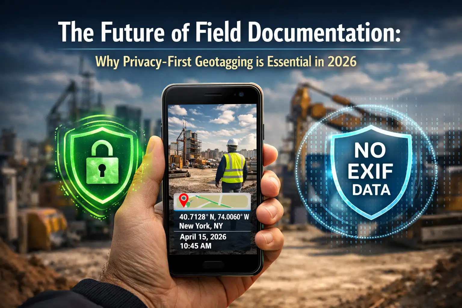
Visual Stamping as a Secure Standard
In 2026, the industry has realized that "invisible" metadata is a liability. It's too easy to lose, too easy to fake, and often contains more data than necessary. A Visual GPS Stamp provides a "summary of truth." It shows the stakeholder exactly what they need to see—the coordinates, the time, and the map—without exposing the hidden technical headers of the file that might contain sensitive device information.
As we detailed in our Online vs Mobile Apps comparison, the future of work is browser-based. It is faster, universal, and most importantly, it respects the boundary between professional documentation and personal privacy.
🏆 Ethics Verdict
Professionalism in 2026 is defined by how you protect data as much as how you collect it. Privacy-first utilities like GPS Map Camera Online offer the ultimate balance: providing verifiable evidence for site reports while ensuring that sensitive images and location trails remain solely under the user's control.
Privacy & Safety Frequently Asked Questions
Capture professional reports with total privacy
Join the privacy-first movement. Generate verifiable GPS photos without sacrificing your data security.
Start Private Stamping Now
Priyanshu built GPS Map Camera Online after running into privacy issues and slow performance with traditional mobile GPS camera apps. He specialises in browser-based tools for field documentation and photo geotagging — keeping everything fast, private, and free.
View all posts →