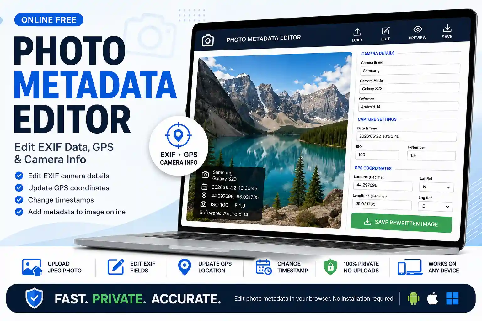
Photo Metadata Editor Online Free – Edit EXIF Data, GPS & Camera Info
Use this photo metadata editor online free to add metadata to image online, update GPS coordinates, change camera make and model, adjust timestamps, and rewrite EXIF fields directly in your browser. It is the simplest way to edit photo metadata on Android, Mac, iPhone, and desktop without installing software.
A photo metadata editor modifies the hidden data layer embedded inside a JPEG file — not the pixels themselves. When you save an edited photo from this tool, the visible image is preserved exactly as it was. What changes is the EXIF block: the structured record of camera details, capture time, GPS coordinates, and technical settings that sits silently inside every photo file.
This matters because EXIF data is what software, platforms, and professionals read when they need to know who took a photo, with what device, when, and where. Editing those fields lets you correct errors, fill in missing data, or update a file to match project records — without touching the image quality.
Common Reasons to Edit Photo Metadata
The need to edit EXIF data comes up in more practical situations than most people expect:
Correcting a wrong timestamp. If your camera's date was set incorrectly — especially after travelling across time zones or after a battery reset — photos end up with wrong capture times. Fixing DateTimeOriginal ensures the record matches when the shot was actually taken.
Adding GPS coordinates after the fact. Some cameras don't have GPS built in, or location services were off at the time. If you know where a photo was taken, you can embed the coordinates so the file carries that information for mapping, reports, or archives.
Field documentation and inspection records. Engineers, surveyors, and contractors often need photos to carry specific project metadata — site name as the camera model field, project ID as the software field, correct GPS of the site — before submitting to a client or regulatory body.
Photography archiving and cataloging. Normalizing camera make/model fields across a mixed library (some from phones, some from cameras) makes bulk organization and filtering much cleaner in tools like Lightroom or Capture One.
Delivery proof and logistics. Proof-of-delivery photos sometimes lack a GPS stamp because the driver's phone had location services off. Adding the coordinates from the delivery address creates a more complete record.
Copyright and authorship fields. Professional photographers often want artist and copyright fields populated before sending work to clients or submitting to stock libraries.
What You Can Edit With This Tool
The editor covers the fields that matter most for real-world workflows, without overcomplicating the interface:
Field
Typical Use
Why It Matters
Camera Make
Brand documentation
Identifies the manufacturer in image archives and search filters
Camera Model
Device identification
Useful for standardizing records across mixed-device shoots
Software
Processing pipeline notes
Records which app, firmware, or workflow produced the file
Date & Time
Capture time correction
Essential for inspection reports, legal records, and project timelines
GPS Latitude & Longitude
Location tagging
Embeds precise coordinates for mapping and location verification
ISO
Sensitivity setting
Part of the exposure record; useful for photography documentation
F-Number (Aperture)
Optical settings record
Preserves the full exposure triangle in the file's metadata
How to Edit Photo Metadata — Step by Step
Step 1 — Load your photo. Click "Load JPEG Photo to Edit" and select a .jpg or .jpeg file from your device. The image appears in the preview area and the existing metadata is read into the fields.
Step 2 — Check what's already there. Before making changes, it helps to see the full current metadata. Use the Photo EXIF Viewer first if you want a complete picture before editing.
Step 3 — Update the fields you need. Edit any combination of camera make, model, software, date/time, ISO, F-number, and GPS coordinates. You don't need to fill in every field — only the ones you want to change.
Step 4 — Set GPS correctly. For GPS, enter the decimal latitude and longitude values and select the correct hemisphere reference (N/S for latitude, E/W for longitude). If you're unsure of the exact coordinates, Google Maps shows them when you right-click any location.
Step 5 — Save the rewritten image. Click "Save Rewritten Image" to download the updated JPEG. The file will contain your new metadata embedded in the EXIF block, with the original image pixels unchanged.
Important Limitations to Know Before You Start
Being clear about what this tool does and doesn't do saves frustration:
JPEG only. EXIF editing requires a specific file structure. This tool supports .jpg and .jpeg files. PNG, WebP, HEIC, and RAW formats are not supported here — those require dedicated desktop software.
The visible image is not re-encoded. The tool rewrites the EXIF header but doesn't decompress and recompress the image data. This means no quality loss from re-encoding — but it also means visual properties like brightness, color, or resolution are not affected.
Edited metadata can be verified. After downloading, you can verify what was written by uploading the same file to the EXIF Viewer. This confirms the fields saved correctly before you use the file in a report or submission.
Some platforms strip EXIF on upload. If you plan to share the edited file on social media, be aware that Instagram, WhatsApp, and most messaging apps will strip the metadata you just added. For use cases where metadata needs to survive — reports, client deliverables, archiving — keep the original downloaded file rather than re-sharing through these platforms.
Nothing is sent to a server. All file reading and EXIF rewriting happens locally in your browser using JavaScript. Your photo never leaves your device during this process.
Browser and Device Compatibility
The tool works in any modern browser that supports the File API and JavaScript — which is essentially every browser in active use today. This includes Chrome, Safari, Firefox, and Edge on desktop, and Chrome for Android and Safari on iPhone. No app installation or browser extension is needed.
On Android, open the page in Chrome, tap "Load JPEG Photo to Edit," and select your photo from the gallery. The editing fields and save button work the same as on desktop. On iPhone, use Safari and choose your photo from the Photos library when prompted. The downloaded file saves to your Files app.
How This Fits With the Other Tools on This Site
This editor is one part of a connected set of EXIF tools, each covering a different part of the metadata workflow:
Start with the Photo EXIF Viewer to read all current metadata before deciding what to change.
Use this editor to update specific fields — camera info, timestamps, GPS coordinates.
Use the Photo EXIF Remover if you want to strip all metadata before sharing a photo publicly.
Use the Photo Location Finder to map the GPS coordinates in a photo after editing, to confirm the location is correct.
For photos that need a visible GPS stamp overlaid on the image itself (not just in the hidden metadata), the GPS Map Camera Editor handles that.
Frequently Asked Questions
No. This tool rewrites only the EXIF metadata header in the file. The image pixel data is not touched, decoded, or re-encoded during the process. The downloaded file will be visually identical to the original — only the hidden metadata fields you edited will be different. There is no JPEG recompression step, so no quality loss occurs.
Upload the photo, then fill in the GPS Latitude and Longitude fields with the decimal coordinates of the location where the photo was taken. Make sure you select the correct hemisphere reference — N or S for latitude, E or W for longitude. If you're unsure of the coordinates, open Google Maps, right-click the location, and the decimal coordinates will appear at the top of the context menu. After saving, use the Photo Location Finder to confirm the pin appears in the right place.
Open this page in Chrome on your Android phone. Tap "Load JPEG Photo to Edit" and select a photo from your gallery. Fill in the fields you want to change, then tap "Save Rewritten Image." The updated file downloads to your phone's Downloads folder. No app installation is needed — it works entirely in the browser. Note that if your photo was shared via WhatsApp or a social app before uploading, its original metadata may already have been stripped.
Yes. The tool works in Safari, Chrome, or Firefox on macOS without any installation. Open the page, upload your JPEG, edit the metadata fields, and download the result. For Mac users who previously used desktop EXIF editors like ExifTool or Photo Mechanic for basic field edits, this browser approach handles the most common tasks without any setup overhead.
After downloading the edited file, go to the Photo EXIF Viewer tool and upload the same file. The viewer will read all the current EXIF tags and display them in organized tables. You can confirm that your updated camera make, model, timestamp, GPS coordinates, and other fields are all present and correct before using the file in a report, client delivery, or submission.
This EXIF Editor writes metadata into the hidden EXIF block of the file — the changes are invisible on the image itself but readable by software and tools that inspect metadata. The GPS Map Camera Editor adds a visible stamp to the photo — a map image, coordinates, and timestamp overlaid directly onto the pixels. Use this tool when you need the metadata in the file's data layer; use the GPS Map Camera Editor when you need the location information to be visually visible in the photo itself.
Priyanshu built GPS Map Camera Online after running into privacy issues and slow performance with traditional mobile GPS camera apps. He specialises in browser-based tools for field documentation and photo geotagging — keeping everything fast, private, and free.